

A Technological Marvel in Disaster Response
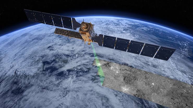
Imagine possessing the ability to measure the earth’s movements with millimeter precision from thousands of miles away. This capability was realized by the Sentinel-1 satellites, part of the European Space Agency’s (ESA) Copernicus program, following a series of devastating earthquakes in northern Venezuela on June 24, 2026. The aftermath revealed a dramatic displacement of the earth’s crust, exceeding initial estimates and highlighting the power of modern technology in assessing natural disasters.
A Closer Look at the Data
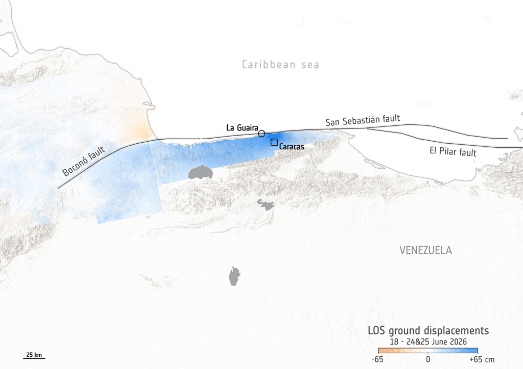
More than a month after the earthquakes, which registered magnitudes of 7.2 and 7.5, updated data uncovered that the ground around Caracas, La Guaira, and Caraballeda had risen by as much as 65 centimeters. The Sentinel-1 satellites, equipped with advanced radar systems, were able to capture this information through their unique method of analyzing the earth’s surface.
The Mechanics of Satellite Observation
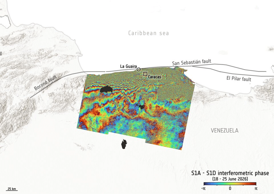
Unlike traditional photography, the Sentinel-1 satellites deploy radar waves that travel diagonally down to the Earth’s surface. By measuring the time it takes for these waves to bounce back, scientists can calculate distances with remarkable accuracy. Through a technique known as interferometry, researchers can compare satellite passes to create detailed maps, known as interferograms, which illustrate changes in distance over time. These visual representations capture the “breath” of the Earth, providing invaluable insights into geological shifts.
Understanding the Causes of Movement
So, what triggered these significant earthquakes? According to the ESA, the seismic activity resulted from the interactions between two tectonic plates: the Caribbean plate, moving eastward, and the South American plate. This tectonic dance occurs primarily along the San Sebastián fault, situated off the coast of Venezuela, at a rate of approximately 15 millimeters per year. The data from Sentinel-1 confirmed that most of the rupture occurred offshore, aligning with previous studies that warned of the potential risks in the area.
Immediate Relief Through Advanced Mapping
In a remarkable display of how technology can be harnessed for humanitarian efforts, the Copernicus Emergency Mapping Service was activated just five hours after the earthquakes struck. Utilizing satellite imagery, the service assessed damage across more than 3,000 buildings and identified around 2.7 million individuals living in potentially affected areas, particularly within the Greater Caracas region and surrounding coastal towns. Nuno Miranda, the head of the Sentinel-1 mission at ESA, emphasized the importance of radar satellites in delivering rapid and critical information following natural disasters.
Long-term Implications for Earth Sciences
The significance of the Sentinel-1 satellites extends beyond immediate disaster response. Their capabilities provide long-term insights into geological faults and contribute to improving preparedness for future seismic events. As technology continues to evolve, the interplay between space science and Earth observation grows more critical. The Sentinel-1 satellites exemplify how space technology can not only save lives but also enhance our understanding of the planet we inhabit.
Editorial note: This article was created by A Bit Lavish Miami’s Magazine as an original editorial reinterpretation based on publicly available reporting. Original source: efectococuyo.com. Read the original article here: https://efectococuyo.com/internacionales/satelites-europeos-ven-como-se-movio-la-tierra-65-cm-tras-terremotos-en-venezuela/.
Images are used for editorial reference with source credit. If an image requires correction or removal, please contact A Bit Lavish.



Venezuela’s Inflation Rate Hits 8.4% in September 2026
The Central Bank of Venezuela has reported an inflation rate of 8.4%...
 2 Mins read
Navigating the Divide: Brazil’s Polarized Election Landscape
As Brazil approaches a critical election, the nation is divided between Lula...
2 Mins read
A Day of Unity and Compassion: Germany’s National Celebration in La Guaira
On Germany's National Day, the embassy in Venezuela took a humanitarian approach,...
2 Mins read
Former GOP Congressman David Rivera Sentenced to 10 Years for Secret Lobbying Tied to Venezuela
David Rivera's sentencing marks a significant moment in the intersection of U.S....
1 Mins read