

A Ground Shaken: The Recent Earthquake in Venezuela
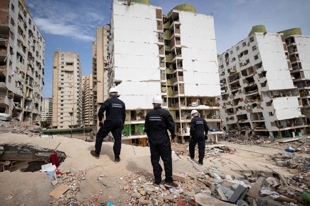
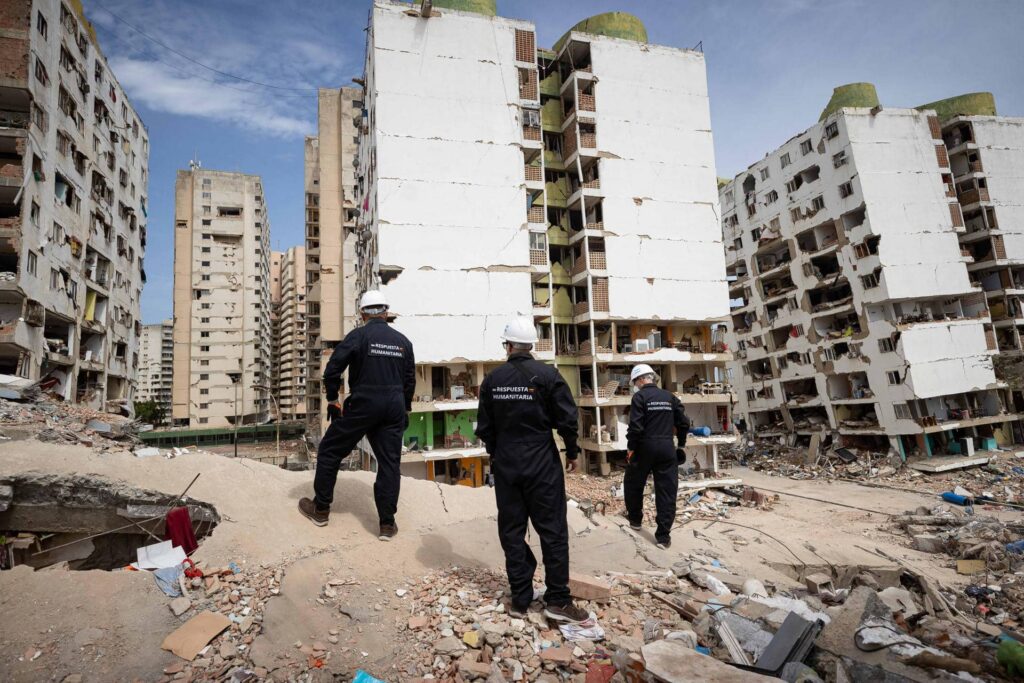
On June 24, 2026, northern Venezuela was rocked by a significant earthquake, registering a magnitude of 7.5. This seismic event was part of a destructive doublet that left residents grappling with the aftermath. As the dust settled, the U.S. Geological Survey (USGS) provided an updated analysis of the earthquake’s epicenter, reshaping our understanding of this natural disaster.
Revising the Epicenter: A Closer Look
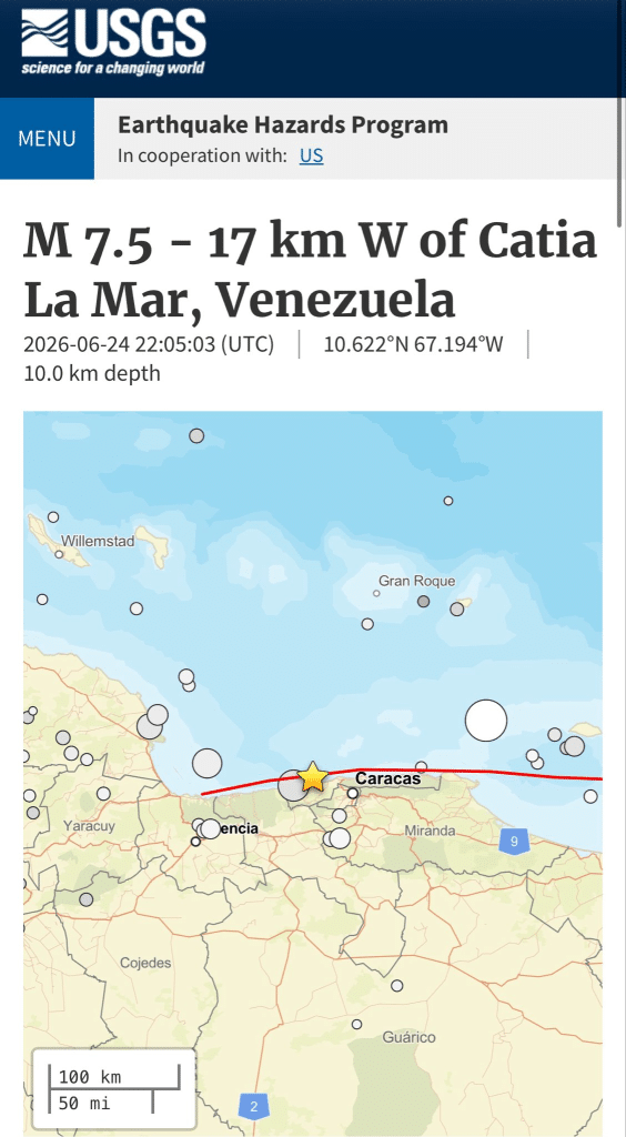
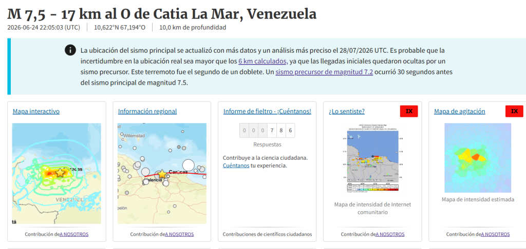
Initially, the USGS had pinpointed the earthquake’s epicenter approximately 28 kilometers southeast of Yumare in Yaracuy state. However, new data surfaced, revealing that the true epicenter lies about 17 kilometers west of Catia La Mar, in Vargas state. This adjustment indicates a location at coordinates 10.622°N 67.194°W, with a depth of 10 kilometers, a shift that highlights the complexities of seismic activity in the region.
The Importance of Accurate Data
The updated findings were driven by the necessity for more comprehensive data and refined analysis. The initial determination was complicated by the presence of an earlier, powerful quake measuring 7.2, which occurred mere seconds before the primary event. This overlap of seismic waves obscured the data, leading to an initial miscalculation.
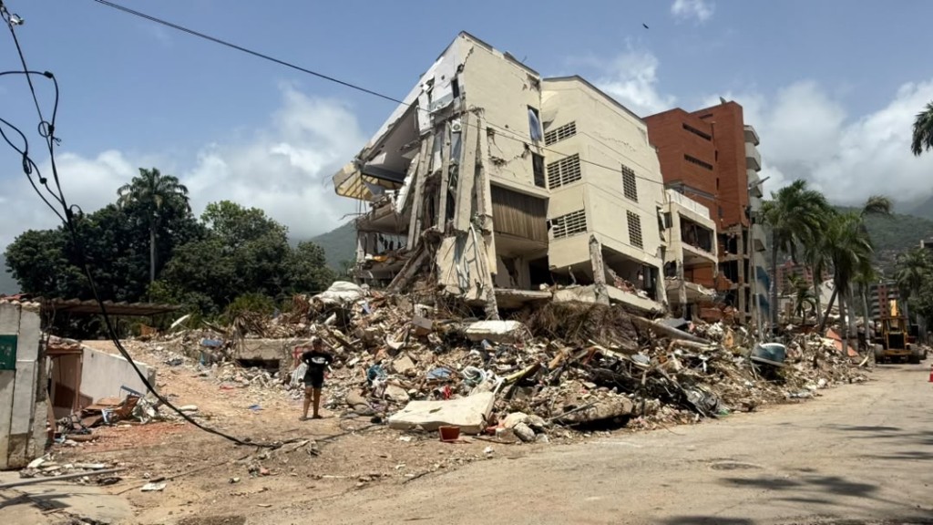
The revised epicenter now aligns more closely with the areas that experienced the most severe damage, such as Caracas and La Guaira, offering a clearer picture of the earthquake’s impact. This shift is crucial for scientists and emergency responders as it enhances understanding of the seismic energy’s propagation and improves future risk assessments.
Seismic Understanding and Future Preparedness
By refining the epicenter’s location, researchers can better analyze the dynamics of this earthquake and similar future events. The implications extend beyond immediate damage assessment; they inform urban planning, emergency preparedness, and public safety measures in a region that has faced its fair share of seismic challenges.
- Understanding the mechanics of earthquakes can lead to better building codes.
- Improved risk models can help governments allocate resources more effectively.
- Public awareness campaigns can be tailored based on accurate data to better prepare communities.
A Global Context: Seismic Activity in the Americas
Venezuela’s recent seismic events echo a larger narrative of tectonic activity across the Americas. The region is home to numerous fault lines and is frequently subjected to earthquakes, making it essential for countries to adopt proactive measures in seismic risk management.
In the context of Miami, where the proximity to the Caribbean and tectonic plates presents its own set of challenges, the lessons learned from Venezuela’s experience are invaluable. As a city known for its vibrant population and bustling infrastructure, Miami must remain vigilant and informed about seismic risks to ensure the safety and well-being of its residents.
Conclusion: A Call for Awareness and Action
The recent updates from the USGS regarding the earthquake in Venezuela serve as a reminder of the unpredictability of nature and the importance of scientific accuracy. As we reflect on these seismic events, it is crucial for communities—both in Venezuela and beyond—to foster a culture of preparedness and resilience. The implications of this earthquake extend beyond borders, urging all to recognize the significance of understanding our planet’s dynamics.
Editorial note: This article was created by A Bit Lavish Miami’s Magazine as an original editorial reinterpretation based on publicly available reporting. Original source: efectococuyo.com. Read the original article here: https://efectococuyo.com/la-humanidad/usgs-determina-que-epicentro-de-sismo-de-75-fue-en-costas-de-la-guaira-y-no-en-yaracuy/.
Images are used for editorial reference with source credit. If an image requires correction or removal, please contact A Bit Lavish.




The Return of María Corina Machado: A New Chapter for Venezuela?
Exploring the implications of María Corina Machado's anticipated return to Venezuela amidst...
 2 Mins read
Navigating Pragmatism: Brazil’s Political Shift and Its Implications for Venezuela
Explore the evolving political landscape in Brazil and its potential effects on...
2 Mins read
Venezuela’s National Assembly Launches Special Commission to Reform Law Against Hate
The Venezuelan National Assembly has initiated a special commission aimed at reforming...
2 Mins read
Trump Praises María Corina Machado Ahead of Her Potential Return to Venezuela
The former U.S. President's endorsement of the Venezuelan opposition leader signals a...
2 Mins read